LOCAL AUTHORITIES AND URBAN AIR MOBILITY
Why is it important for councils to be cost-efficient?
Authorities are continually facing ruthless cuts, resulting in the need to find inventive ways to meet demands on a tight budget. Luckily, the cost of some services can potentially be scaled back by using UAS.
Do councils use drones?
Currently a very small quantity of municipalities and local authorities have adopted and begun utilising drone technology. Early adopters include the municipalities of Trikala and Egaleo,who are trialling schemes to tackle local issues using the technology, as well as investigating ways to integrate relevant training for their workers into their systems.
How can councils use drones?
With the vast array of services that local councils offer, the savings that come from using drone technology are not just related to just cost expenditure. Other improvements include reducing the time taken for operations to be completed, as well as reduced risk to staff. Early evidence from authorities and other industries shows that drones can be implemented quickly to provide immediate benefits.
Here are some examples of how drones can be utilised:
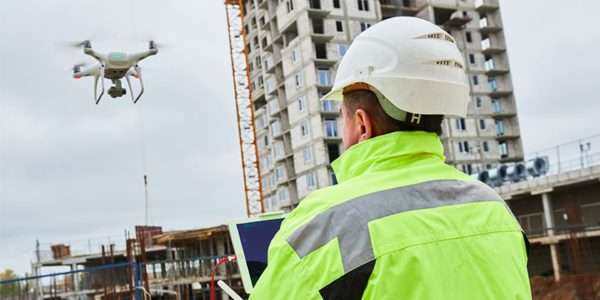
Building/structural inspections
With the large portfolios that each council is responsible for, the cost of outsourcing jobs becomes extremely expensive. Not only do traditional surveys cost more in labour, but they also take a lot longer due to the necessity to erect/takedown scaffolding. By incorporating drones into building surveys, authorities could experience millions in savings whilst negating traditional health and safety hazards that are associated with building surveys.
Site development/land survey
Drone technology can be used to identify and analyse potential sites for housing developments by using photogrammetry to create orthomosaics. Traditional field work requires teams to expend long manhours which, in turn, produce longer mission timelines and higher costs. Instead, you can expect data to be collected and processed up to 10 times faster, acquiring quicker deliverables and shorter project cycles.
Transport management
Drones provide a viable solution for tracking congestion and planning/maintaining roads. Existing methods of traffic monitoring can be overcome by using drone technology due to its ease of use and ability to cover larger areas. Operators can provide high resolution video streams in real-time to control centres. These live streams can be used by on-the-ground personnel to aid their road monitoring, traffic activity analysis, identify and track individual vehicles. The data can also be used in post-event analysis using drone tech to optimise existing traffic count data and provide little disruption.
Enforcement
Local councils are responsible for a variety of enforcement activities including fire and public safety, planning, monitoring illegal camps, fly tipping, establishing boundary limits etc. By using drone technology, authorities can record the effects/damages of traveller groups and domestic disturbances to be used in court.
Coastal Management
Drones can be used to monitor & calculate rates of erosion of cliffs in coastal areas. This enables operators to determine the likelihood and impact of coastal landslides on the environment. By using such technology, organisations can collect repeatable data much faster whilst avoiding the risk of manually trekking along cliff faces. For more information on how you can use drones to cut costs and get more efficient results, get in contact with the Hellenic U-Space Institute here